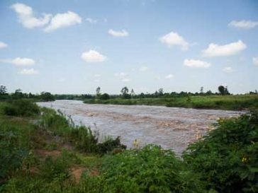
Improved Management of Extreme Events through Ecosystem-based Adaption in Watersheds (ECOSWat)

An increased frequency for extreme weather situations due to climate change has been predicted for Thailand. For mitigating the risks and damages, ecosystem-based approaches do not play much of a role in water resource management practices yet. Within the scope … Read More

Badakhshan Natural Disaster Prevention Project – Improvement and Awareness Raising of Risk Mapping

Flood risk modelling and mapping for the entire Badakhshan Province of Afghanistan based on a combined modelling / remote sensing approach, the development of detailed flood maps, development of guidelines for map use in English and Dari as well as … Read More

Disaster Risk Analysis and Mapping in Badakhshan – Phase 2

Disaster risk analysis and mapping in the Hindu Kush region of Afghanistan focusing on avalanche risk and landslide risk. The assessment and mapping covers the entire Badakhshan province. Actual services provided by our staff within the assignment: Activities include ground … Read More

Disaster Risk Analysis and Mapping in Badakhshan

Thorough disaster risk analysis and mapping in the Hindu Kush region of Afghanistan focusing on avalanche risk, flood risk and landslide risk. Four districts in Badakhshan Province are assessed, described and mapped regarding their risk profile. Actual services provided by … Read More

IALUO – Integrated Assessment of Land Use Options for Climate Change Mitigation and Adaptation

Malawi is under significant pressure from population growth and climate change. It is foreseeable that land and water resources will become scarce and water allocation and water quality aspects will be key for the future sustainable development of the country. … Read More

Responding to Climate Change in Mozambique – Component Water

Through the project “Responding to Climate Change” the Government of Mozambique wants to prepare the country for the negative impacts of climate change while at the same time create opportunities for sustainable growth and investment. The project focuses on identifying … Read More

NBI-NTEAP Wetlands Inventory And Mapping In The Nile Basin

Wetland mapping in the whole of the Nile Basin. The project aims at identifying the wetland resources and ecological hotspots in the basin and includes field trips as well as stakeholder consultation, data evaluation, the processing of Landsat satellite imagery … Read More

1 2