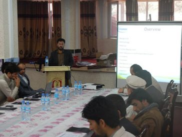
WEAP Modelling Training for Ministry of Energy and Water
Provision of a two week comprehensive WEAP training course to the Water Resources Planning Unit at the Ministry of Energy and Water in Kabul. The training is designed to enable the WRPU to fully utilise the WEAP Western Basins model. … Read More
Improved Management of Extreme Events through Ecosystem-based Adaption in Watersheds (ECOSWat)
An increased frequency for extreme weather situations due to climate change has been predicted for Thailand. For mitigating the risks and damages, ecosystem-based approaches do not play much of a role in water resource management practices yet. Within the scope … Read More
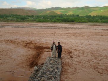
Badakhshan Natural Disaster Prevention Project – Improvement and Awareness Raising of Risk Mapping
Flood risk modelling and mapping for the entire Badakhshan Province of Afghanistan based on a combined modelling / remote sensing approach, the development of detailed flood maps, development of guidelines for map use in English and Dari as well as … Read More
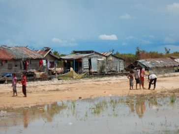
Recovering Living Conditions and Building Resilience of Communities Affected by the 2013 Floods in Cambodia
Study on community safe areas negatively affected by the 2013 floods. The overall purpose of the consultancy is to assess the condition and potential flood safety of identified community safe areas in flood prone areas in Sereisophon and Mongkul Borei … Read More
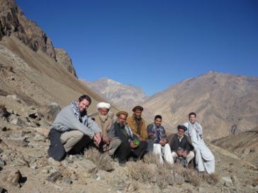
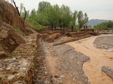
Disaster Risk Analysis and Mapping in Badakhshan – Phase 2
Disaster risk analysis and mapping in the Hindu Kush region of Afghanistan focusing on avalanche risk and landslide risk. The assessment and mapping covers the entire Badakhshan province. Actual services provided by our staff within the assignment: Activities include ground … Read More
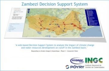
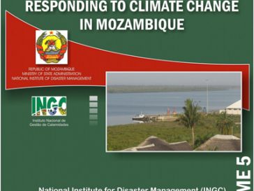
Responding to Climate Change in Mozambique, Phase III – Development of a Flood Extension for the Zambezi DSS and Real Time Flood Forecasting Pilot
The project expanded the Zambezi Water Resources Decision Support System (ZDSS: hosted at http://hydro.poyry.at/zambezi/) developed by Hydroc under INGC Phase II to include flood inundation mapping and zoning under a variety of potential development options and climate change scenarios, … Read More
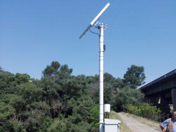
Detailed Design and Construction Supervision for Hydrological Stations and an Integrated Water Resources Management Information System (IWRMIS)
The existing hydrological measuring station network in Zambia has deteriorated since the early 90s. Poor quality of available hydrological data makes water management and data utilisation difficult. The objective of the project was the establishment of an Integrated Water Resources … Read More
Responding To Climate Change In Mozambique, Phase III – Agricultural Pilot Project Implementation
Under Phase II of the INGC climate change projects in Mozambique a proposal for adapted agricultural water management under climate change conditions has been developed. The proposed measures aim at sourcing and utilising alternative water resources as well as adjusted … Read More
ORASECOM IWRM Plan, Transboundary Water management in SADC
The Orange-Senqu River Basin Commission (ORASECOM) has started work on the consolidation of a basin-wide Integrated Water Resources Management (IWRM) plan through Phase 3 of a GIZ support programme. The plan provides a framework for management, development and conservation of … Read More
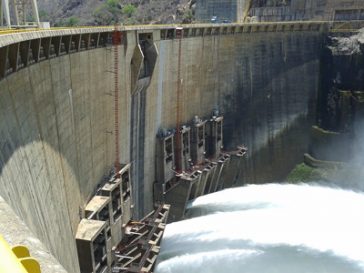
Responding to Climate Change in Mozambique, Phase III – Cahora Bassa Hydropower Scheduling
Water resources of the Zambezi River are being increasingly utilised, resulting in the necessity to assess how to best utilise the water resources considering competing stakeholder needs. The objective of the project is to assess the ability of Cahora Bassa … Read More
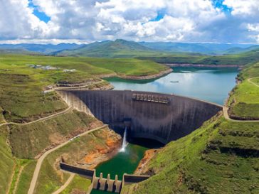
Climate Change Adaptation and Impact Assessment Study for Munda Dam
Munda Dam is a multipurpose project catering for hydropower, irrigation water and flood protection purposes. The objective of the study is to assess the feasibility for constructing a hydropower dam in Munda, Pakistan. Works focus on climate change adaptation and … Read More
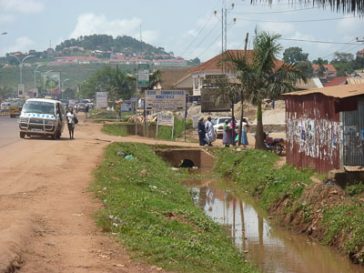
Integrated Flood Management in Kampala, Overall Assessment of Flood Risk with Pilot Flood Hazard Mapping under Climate Change
The project is conducted according to the principles of integrated flood management, carried out under the auspices of UN-Habitat’s Cities and Climate Change Initiative (CCCI). The objectives of the assessment include 1. a comprehensive, city-wide assessment of the risks of … Read More
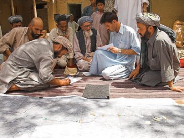
Disaster Risk Analysis and Mapping in Badakhshan
Thorough disaster risk analysis and mapping in the Hindu Kush region of Afghanistan focusing on avalanche risk, flood risk and landslide risk. Four districts in Badakhshan Province are assessed, described and mapped regarding their risk profile. Actual services provided by … Read More
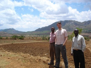
IALUO – Integrated Assessment of Land Use Options for Climate Change Mitigation and Adaptation
Malawi is under significant pressure from population growth and climate change. It is foreseeable that land and water resources will become scarce and water allocation and water quality aspects will be key for the future sustainable development of the country. … Read More
Responding to Climate Change in Mozambique – Component Water
Through the project “Responding to Climate Change” the Government of Mozambique wants to prepare the country for the negative impacts of climate change while at the same time create opportunities for sustainable growth and investment. The project focuses on identifying … Read More
Climate Change Impact Assessment in Agriculture and Water Sectors Study
The project entails collecting and collating necessary information (geological, hydro-meteorological and physiographic data) in order to analyse the impacts of climate change and variability consequences, e.g. changes in precipitation and temperature on water and agricultural sectors, including runoff, irrigation, flooding, … Read More
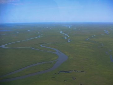
NBI-NTEAP Wetlands Inventory And Mapping In The Nile Basin
Wetland mapping in the whole of the Nile Basin. The project aims at identifying the wetland resources and ecological hotspots in the basin and includes field trips as well as stakeholder consultation, data evaluation, the processing of Landsat satellite imagery … Read More
RIMAX Guide – Risk Management In Extreme Flood Events
Development of a UNESCO risk management guide for extreme flood events including adaptation strategies for developing countries. The guide explains research projects conducted under RIMAX and shows adaptation strategies to use the research results in the context of the developing … Read More